I have fond memories of California that date back to a family holiday at Disneyland in 1996. My ten-year-old impressions of California were that the sunshine is endless, the people are super helpful/friendly and soda is cheap. Keen to check whether this depiction was accurate, I was absolutely stoked to learn Visit California were sending Kyle and I to North California for a summer roadie. For the weeks leading up to our departure I couldn’t stop singing ‘California, California – here we come!’
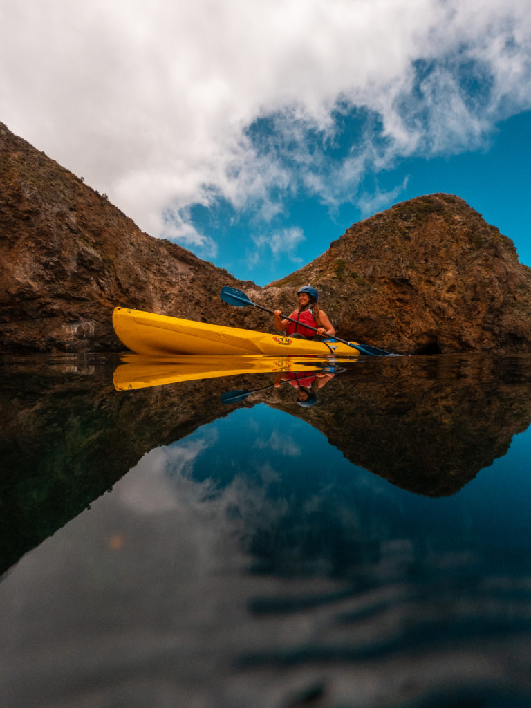
We touched down in Los Angeles and successfully navigated our way out of the city. There are direct flights from Auckland to San Francisco but we spent a couple of days driving up the coast following Highway 1. This allowed us to kayak through sea caves with Santa Barbara Adventure Company and Ventura County Coast around the Channel Islands National Park.
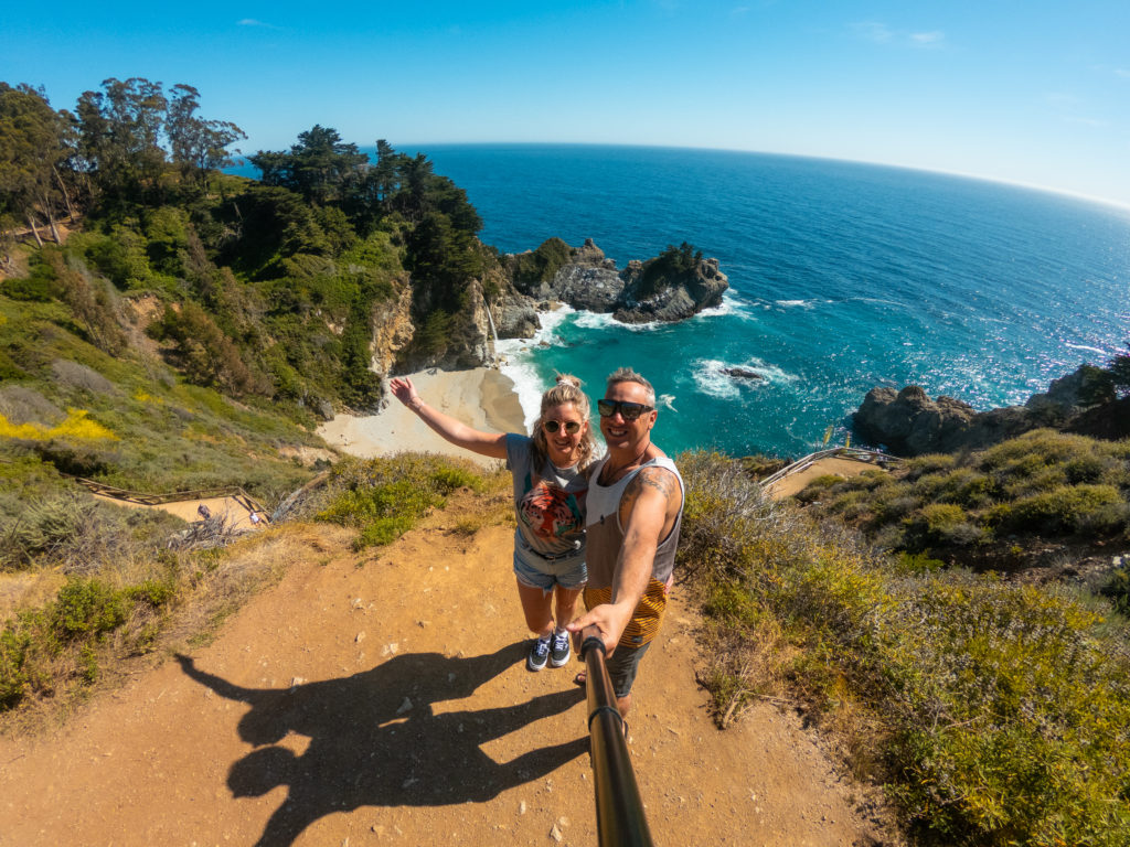
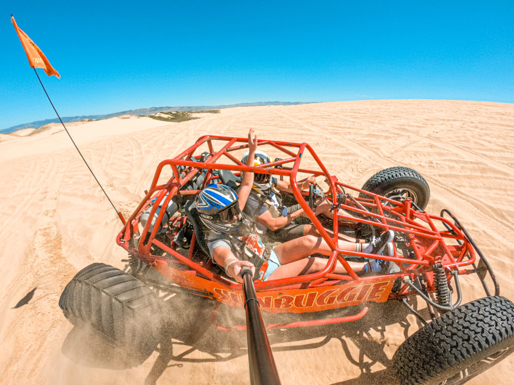
Then we headed up to San Luis Obispo County and sped around in a dune buggy at Oceano Dunes State Park near Pismo Beach, before exploring the scenic coastal Highway 1, driving north through Big Sur to San Francisco.
Our North California road trip (or ‘NorCal’, as it’s known) officially began in Redding in the Shasta Cascade region, which is a short one-hour flight or five-hour drive north of San Francisco. First on the itinerary was a visit to Lake Almanor. Being a Sunday afternoon, there were lots of family groups out enjoying brews and bbq’s at the lake. We hired a couple of paddle boards from Lake Almanor Kayaks and set off from the beach at Canyon Dam picnic area. The best beach on the lake, according to locals.
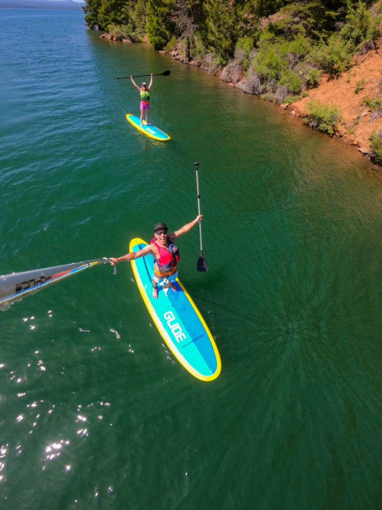
After an hour of paddling along the shoreline we took the plunge into the lake, experiencing our first swim of the road trip. The water temperature was very refreshing and somewhat breathtaking, the region still experiencing snow melt from winter. With our ‘NZ winter-tanned’ bodies already feeling the sun’s intensity, we returned the boards and made our way to our first night’s accommodation, The Village at Childs Meadows.
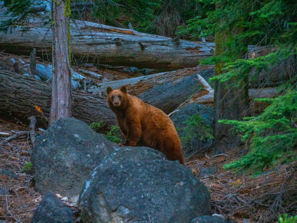
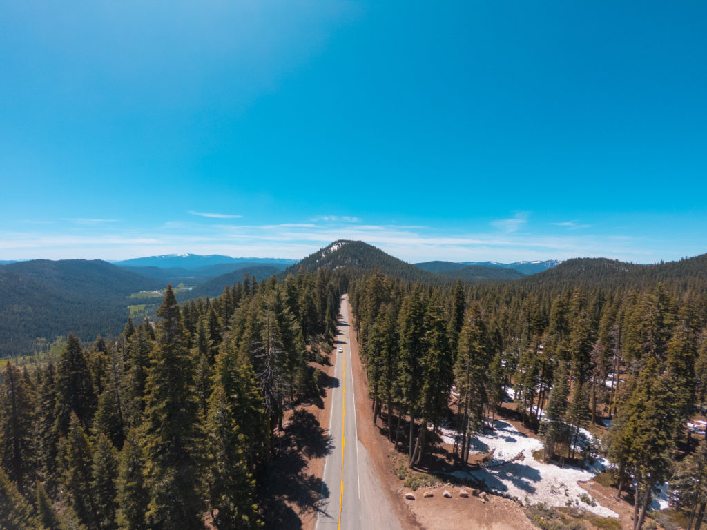
In true Kyle fashion, we were up for sunrise the next morning. Absolutely no idea where to go to capture a sunrise shot though. We’d heard that a bear was seen yesterday at nearby Mill Creek, so off we headed in search of said bear. Driving towards Lassen Peak Volcanic Park, just a 10-minute drive from Childs Meadows, unbelievably, right on the side of the highway was a bear!
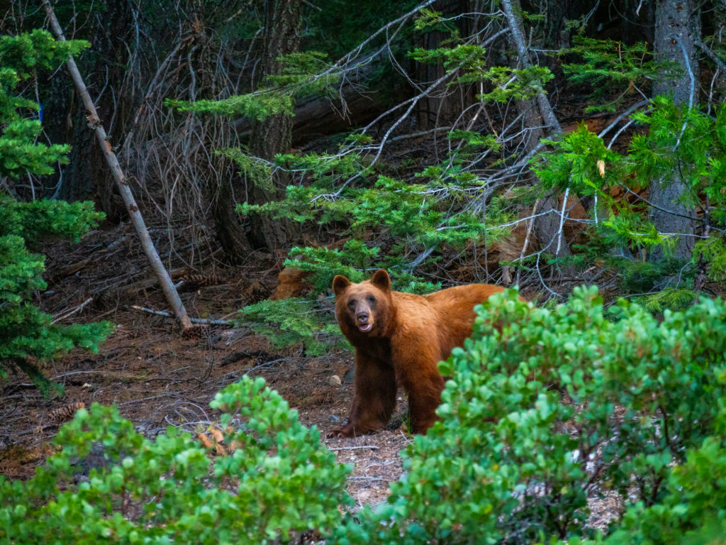
We turned around immediately and swapped seats, slowly driving past the bear again so Kyle could capture images from the passenger seat. The bear was wary of us and eventually scampered off into the forest, away from the road. Neither of us could believe our eyes – or luck!
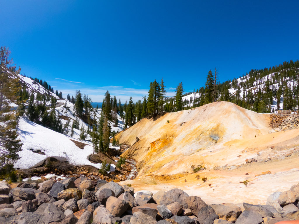
Later that morning we visited Lassen Volcanic National Park, an area rich in geothermal activity. Think Rotorua, in New Zealand, but on a much larger scale! The park’s entrance sits at an elevation of 2,000 metres and Lassen Peak is over 3,000 metres. Due to an annual average snowfall of 1.8 metres the road through the National Park is closed during winter.
Despite it being early June when we visited, the road had only been cleared of snow as far as the Sulphur Works, which is 1 mile past the Kohm Yah-mah-nee Visitor Center. I’m not going to lie – this was pretty devastating. A visit to the Sulphur Works had given us a taste of how epic Lassen Park is and we were keen to see more.
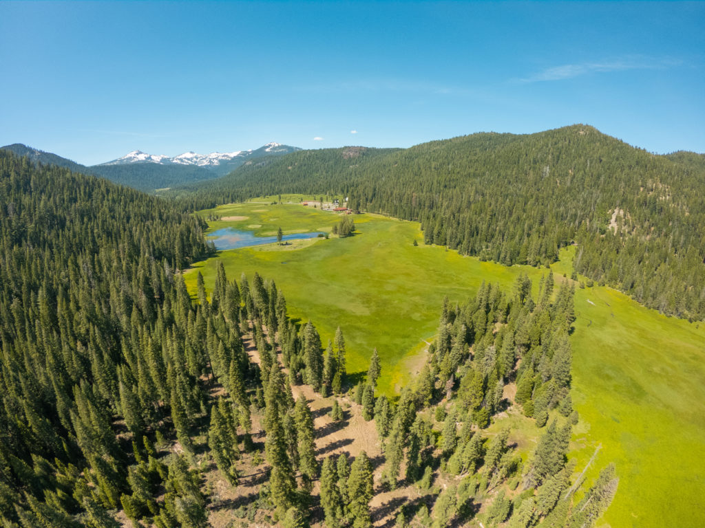
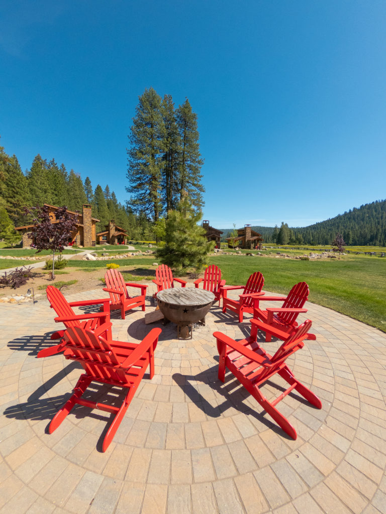
After taking a wrong turn on our way to Boiling Springs Lake and ending up on a gravel road that kept forking in different directions, we sought refuge at our second night’s accommodation in the Lassen region: Highlands Ranch Resort. Kyle and I were fortunate enough to spend a night in the luxurious Night Hawk Cottage. It’s a destination in its own right and bigger than our house!
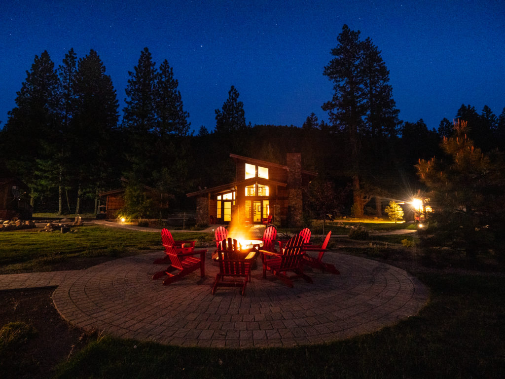
The cottages all form a semi-circle around an outdoor brazier, and face out towards the Meadow. There’s an onsite restaurant and bar with a menu so good it makes choosing your meal impossible, while the selection of spirits at the bar has to be seen to be believed. Oh, and a complimentary mimosa is included with breakfast. They sure knew how to win my heart!
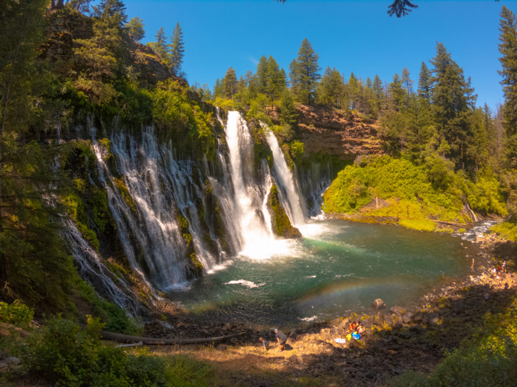
McArthur-Burney Falls Memorial State Park was our next stop. We met with local park interpreter, Marlon, who guided us around the park and Burney Falls. What a legend! Marlon looked the epitome of a US ranger and his wealth of knowledge about, and genuine passion for, the park was totally evident.
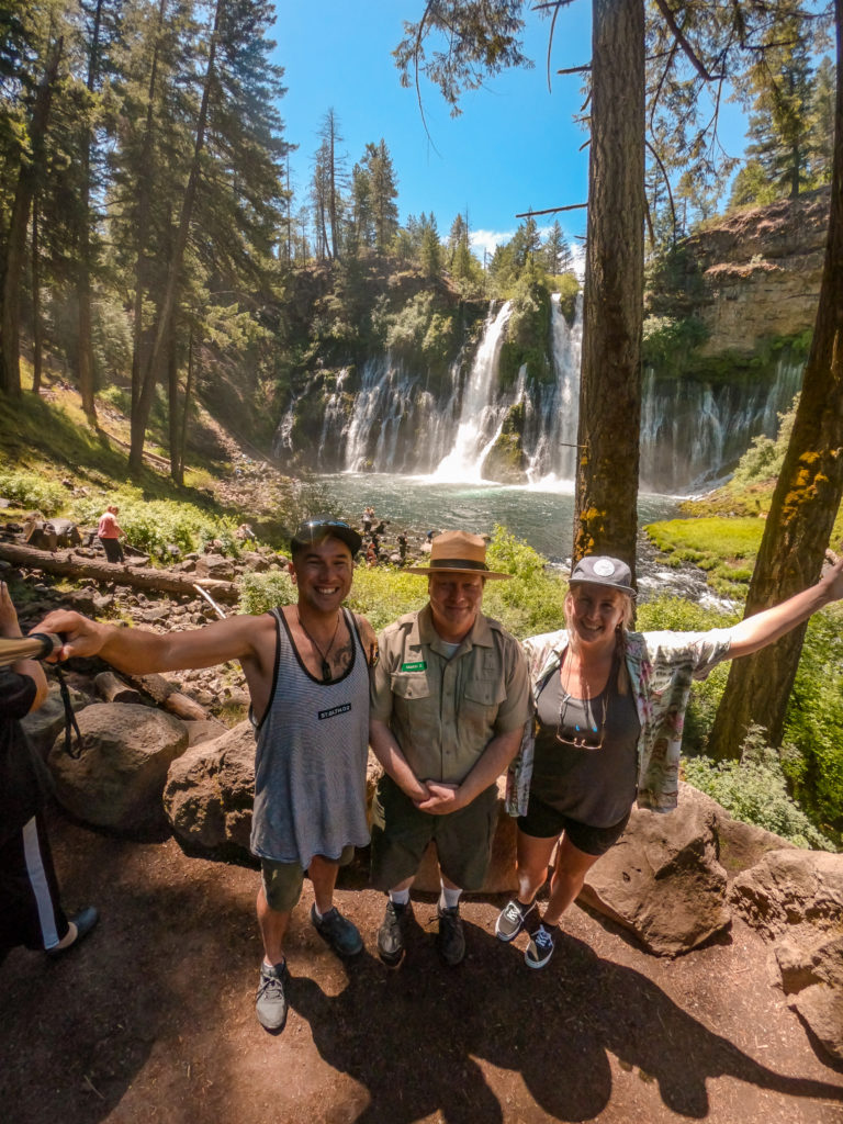
The three of us walked the beautiful Burney Falls Loop Track. Poor Kyle, all he wanted to do was clamber down onto the rocks, in the direct path of the spray, and take a selfie with the 40 metre waterfall in the background – but the park has access regulations to protect its stunning natural beauty. Jokes aside, the falls were way more impressive than what these images portray!
Farewell Marlon and Kia Ora Robin, our local Mount Shasta guide and author of Mount Shasta Guide to Fun. A distractingly breathtaking drive to Mount Shasta did result in us arriving late… sorry again, Robin! But this is why we were late:
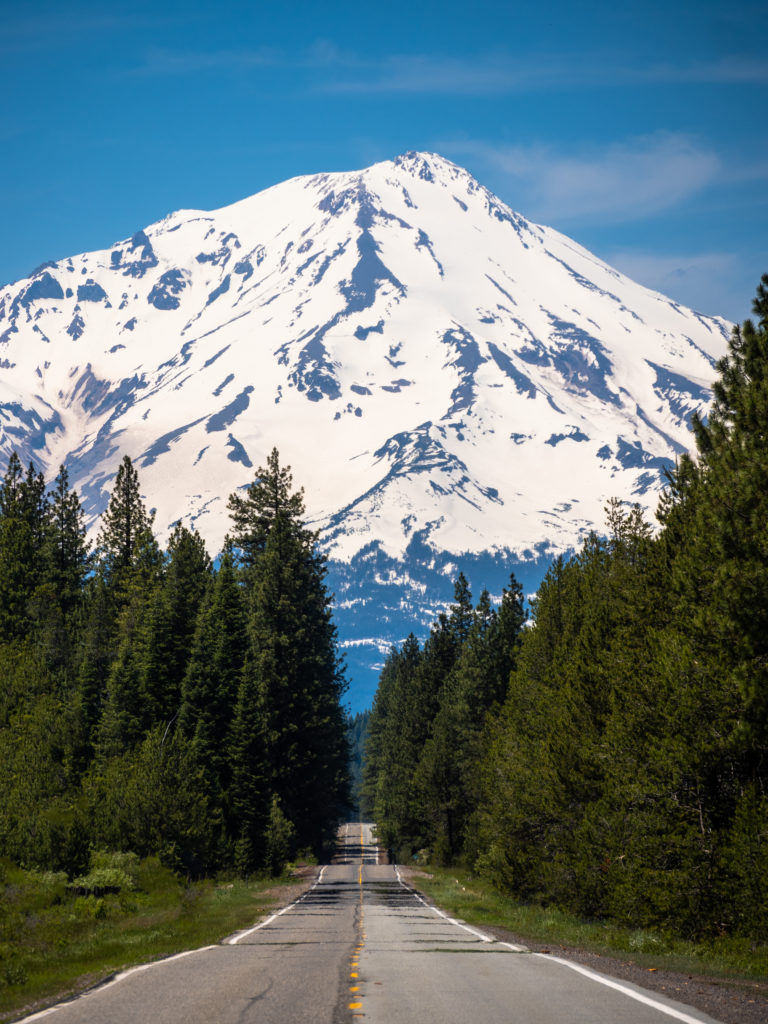
Mount Shasta is known worldwide as a spiritual energy vortex. There are 13 sites considered to have special energy, and visitors come to connect with the energy of the mountain. Kyle discovered this when he first Googled Mount Shasta. It’s shrouded in myths and legends, one being that a secret city is hidden beneath its peak. Some say the city is no longer inhabited, while others believe it’s inhabited by a technologically-advanced society of human beings or mythical creatures, named Lemurian’s. Mount Shasta is very much a spiritual place and also home to eleven crystal shops!
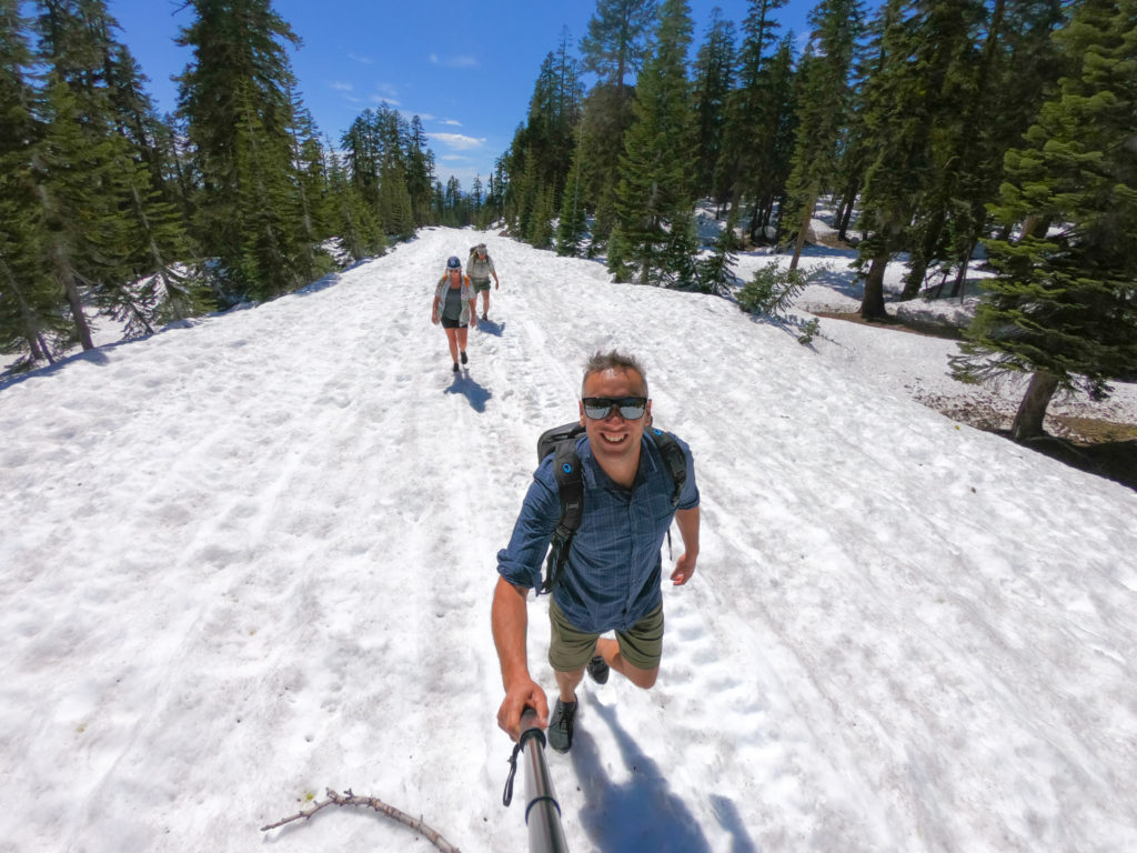
Our guide Robin drove us up Mount Shasta to Bunny Flat car park. Here we learned that we were going to hike up the road, which was still closed due to heavy snow. I shot Kyle a dark look. “Nah babe, you won’t need your hiking boots”, said Kyle when we were packing for our trip. Kyle and I were those classic tourists who turned up unprepared for the conditions but Robin just shrugged it off saying “you’ll be ok, the snow is firmly packed.”
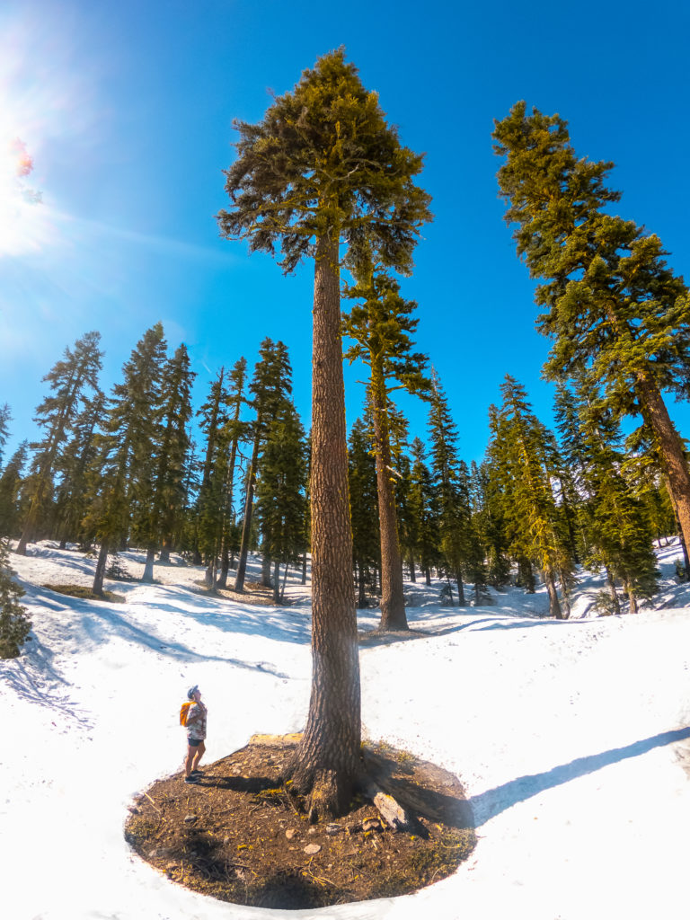
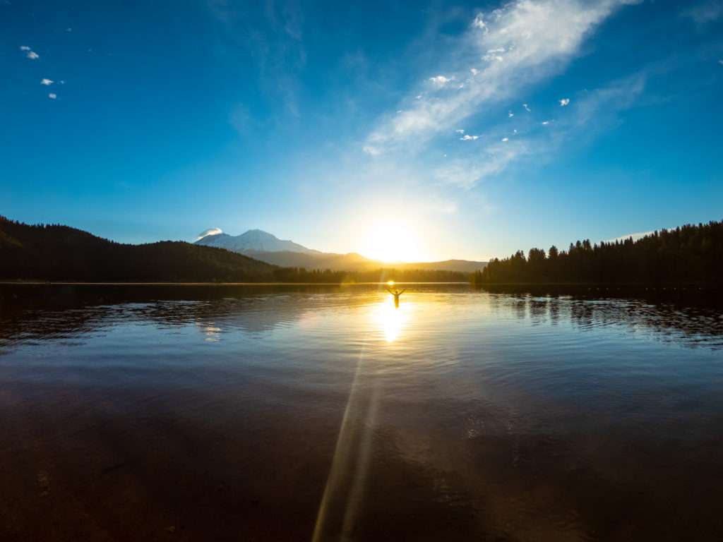
We hiked back down to the car park discussing possible sunrise locations. Robin then drove us to an idyllic picnic spot on Siskiyou Lake, which overlooks Mount Shasta. It was around 33 degrees Celsius and all I wanted was a swim in the enticing lake. I got one the following morning at 6:30 am. Kyle got his sunrise shot.
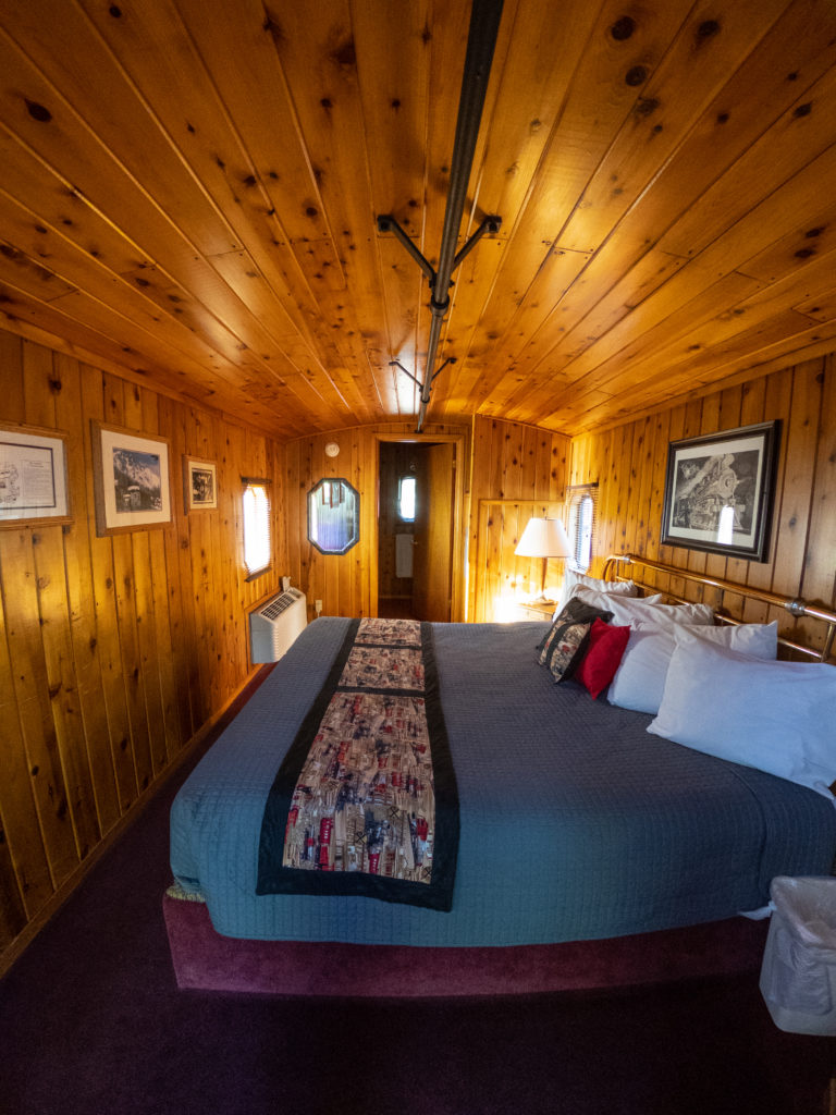
I’m just going to press rewind for a moment as I want to mention Railroad Park Resort, our accommodation the previous night. Talk about novelty! It was like we were hanging out on the Thomas the Tank Engine movie set. Railroad Park Resort is an incredible place, comprised of cabooses that have been refurbished and transformed into fully-fledged hotel rooms. The cabooses are dotted around the property and all sit atop railway tracks. There’s even an onsite restaurant that gives you the opportunity to dine inside a railway carriage and communal fire pit, spa and swimming pool.
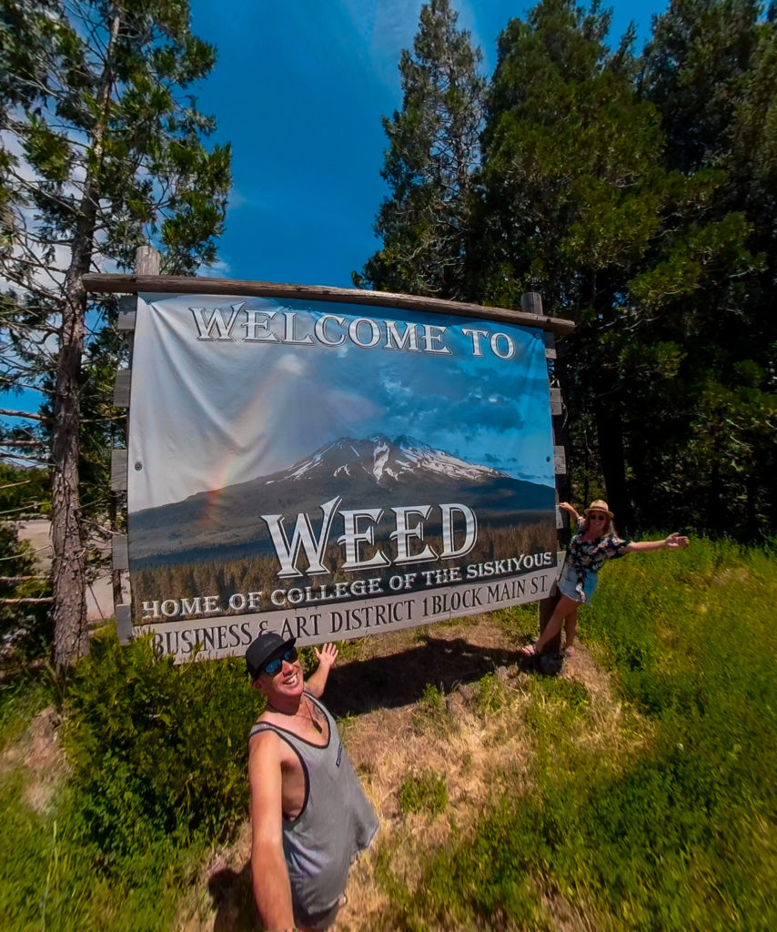
The northernmost destination of our trip was a town called Weed, named after a man whose surname was Weed. Unsurprisingly, the town has accepted, and embraced, its association with marijuana. There’s plenty of “I Love Weed” t-shirts and souvenirs available. And yes, Kyle and I got a selfie with the welcome sign.
Nearby is Stewart Mineral Springs. We checked in and experienced a phenomenal 50 minute deep tissue massage from one of their therapists. I never get massages, and ignore Kyle when he suggests I go for a massage every time. This massage, however, made me question my stubbornness – not that I’ll tell Kyle this. Next was a 70 minute bath house experience. If you know Kyle, you’ll know he can’t sit still for more than five minutes, but I was determined not to let him ruin it for me.
The mineral qualities of the water at Stewart Mineral Springs is only shared with Glastonbury, in the UK. This is what makes is such a special place. We were assigned individual baths in private rooms. You could smell the mineral properties of the water, a faint smell of sulphur, almost. After soaking in the bath it was time for the wood fired sauna. I only lasted five minutes in the sauna before needing to cool off in the plunge pool, a natural swimming hole in the river. I continued this pattern until our allocated time was up.
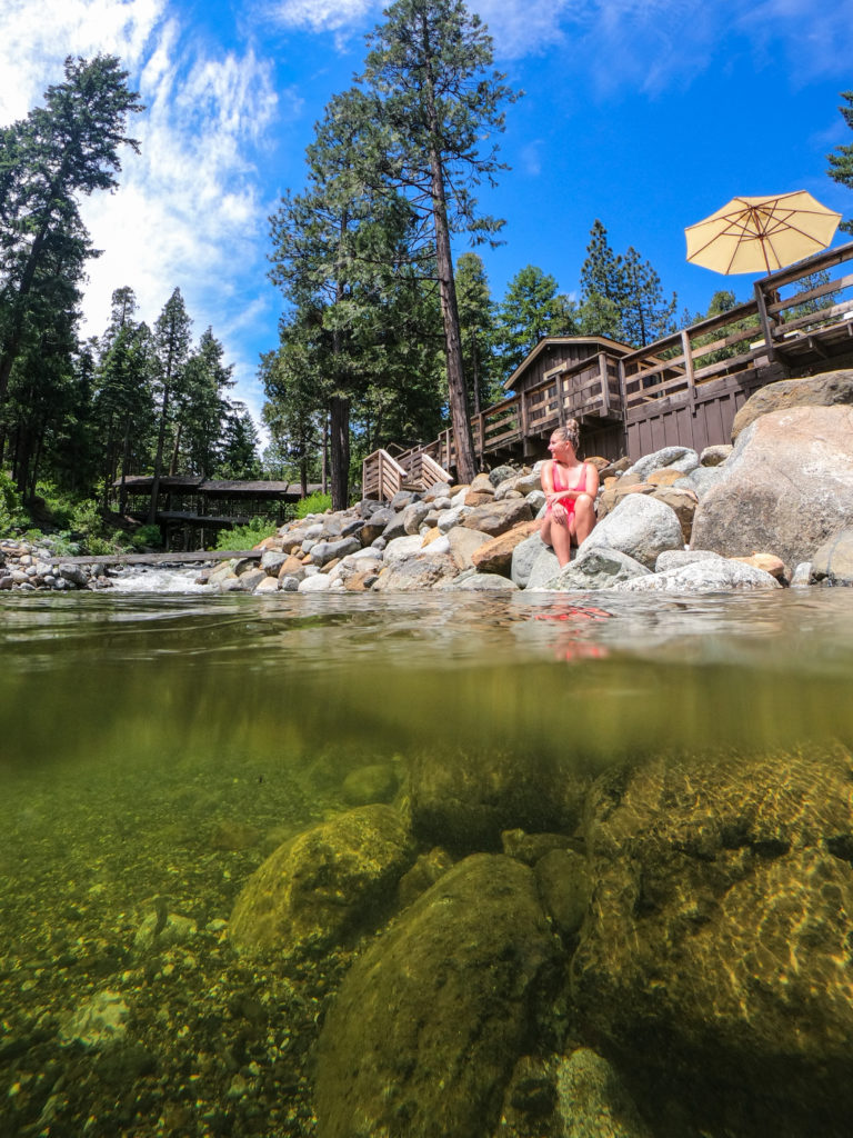
It was time to head south from Shasta. The afternoon was spent driving the best part of 375 km, approximately four hours, as we made our way to The Sanctuary Treehouse, our accommodation at Pine Grove in Cobb that night. Picture a quintessential rustic treehouse with some extra homey touches for comfort (just be aware – the nearest bathroom is 300 metres away).
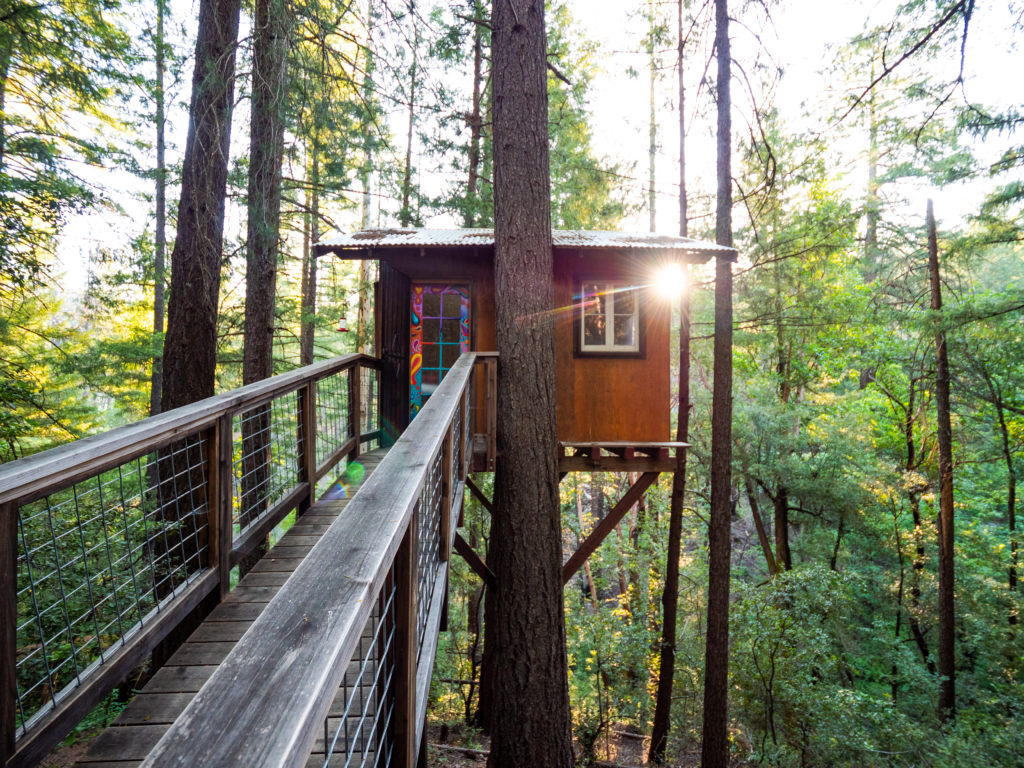
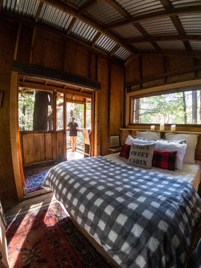
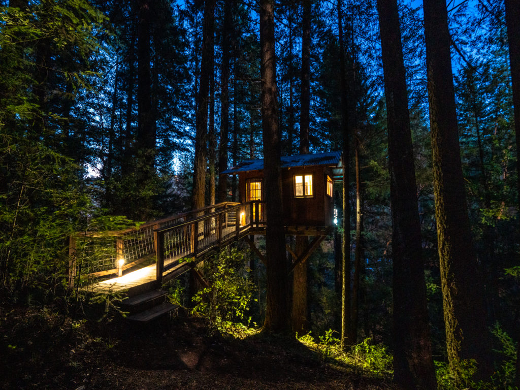
Beneath the treehouse was a path that led to a secluded swimming hole. We cooled off by having a dip in the river and then enjoyed a picnic dinner in the treehouse. When darkness fell Kyle couldn’t help but capture some night images of our arboreal abode.
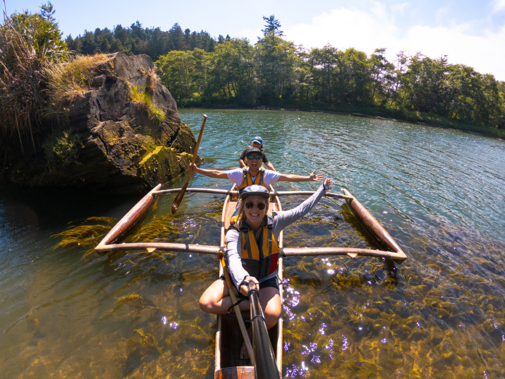
Day five of our NorCal road trip saw us driving to the coastal township of Mendocino, a picturesque spot that reminded Kyle and I of Nova Scotia, on the east coast of Canada. We met Jason from local company Catch a Canoe for lunch and then set out on a two-hour guided river paddle up the Big River Canyon in search of harbour seals and sea otters. (Tip: request Sarah as your guide – she was amazing.)
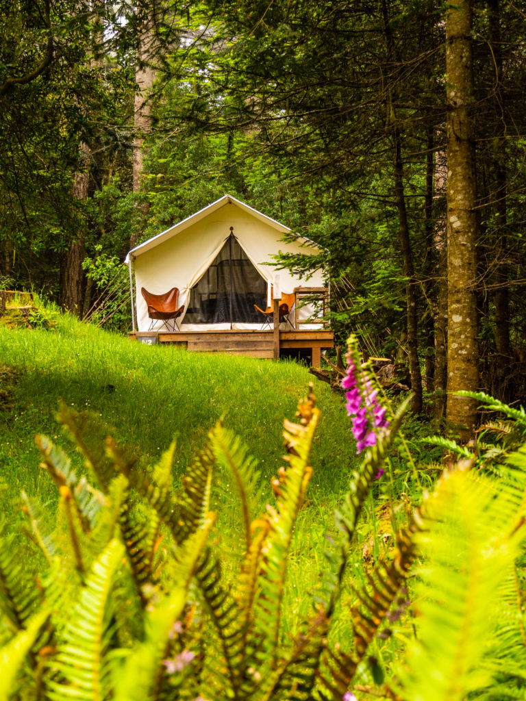
Our home for the evening was Mendocino Grove, a unique glamping site situated on bluffs overlooking the Pacific Ocean. The large canvas tents are outfitted with on trend furnishings. Each tent has its own deck and fire pit. Kyle and I were in heaven.
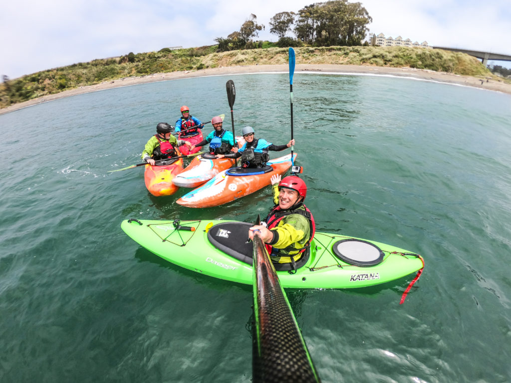
I decided it would be to everyone’s benefit if I didn’t join the Liquid Fusion kayak trip, White Water of the Sea, which departs from Noyo Beach. I’m really not the most adventurous person and kayaking over rocks, or rock gardening as they call it, just doesn’t appeal to me! Kyle, on the other hand, came back from the trip full of adrenaline with a gleam in his eye.
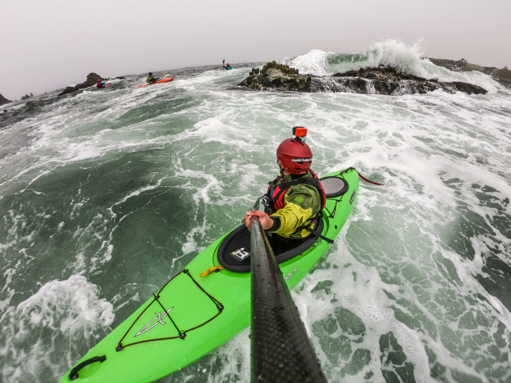
When asked to describe the morning’s events, a grinning, stoked Kyle responded: “That is off-the-charts adrenaline! It can get pretty wild out there but Jeff and Cate [the company owners] were incredibly professional and took safety very seriously. They conducted a skills session with the group to check everyone was of similar capabilities before getting straight into it. Three full hours of pure action!” It was Kyle’s number one highlight from the whole trip and he rates it as one of his top five things to do globally!
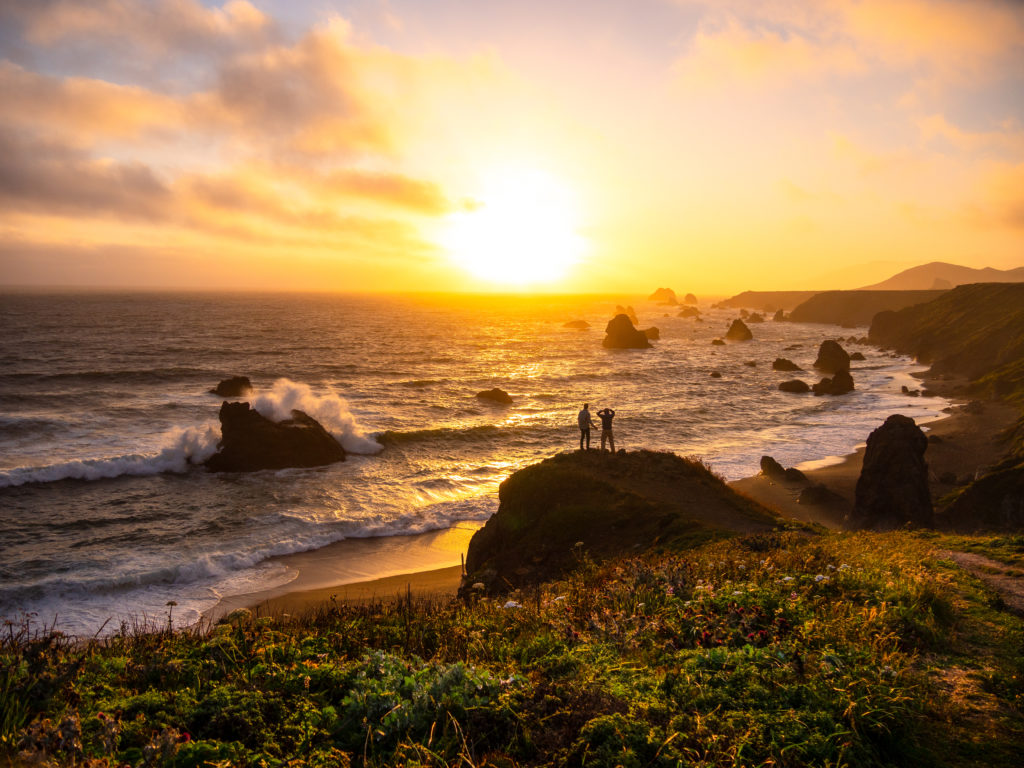
After days of wall-to-wall sunshine, low cloud and sea fog descended along the coast as we drove south from Mendocino, past Point Arena Lighthouse and Bowling Ball Beach. The weather on the coast hadn’t been favourable and Kyle was desperate to capture a stunning coastal sunset. Then, as if the sunset gods were listening to his pleas, a patch of golden sunshine greeted us along the Sonoma Coast.
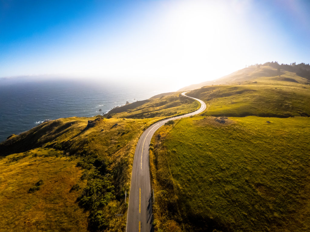
On route to The Inn at The Tides, our accommodation in Bodega Bay that night, an executive decision to shoot sunset was made. Finding this incredible location on the Sonoma Coast was nothing but good luck. There wasn’t a single sign from the road for Furlong Gulch. It was only after an extensive search of the coastline on Google Maps I discovered the name of the beach.
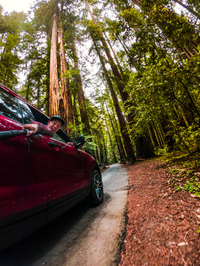
The next day, a visit to Armstrong Redwoods State National Reserve in Sonoma County concluded our North California road trip. Redwood trees are the tallest living things on our planet and their sheer size is incomprehensible. One of the redwoods in this grove is almost 95 metres in height and some trees are estimated to be over 1,400 years old!
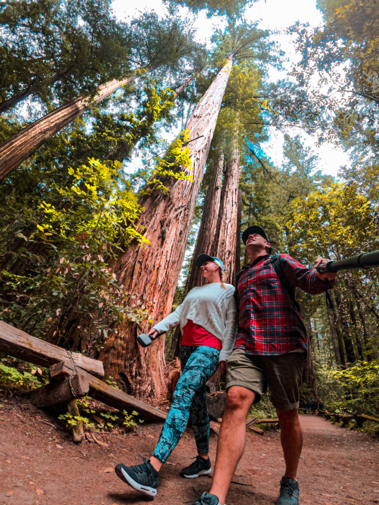
A lot of the redwoods in the area were sacrificed for logging but luckily a lumberman chose to preserve this portion of the park in the 1870s. The grove had a majestic feel and we found ourselves wandering around the park for hours, until it was time to drive south and catch our flight from San Francisco to New Zealand.
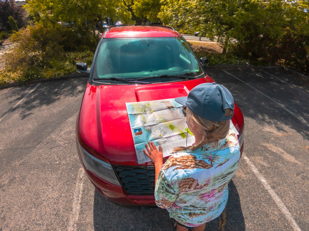
Reflecting on the trip, driving really is the best way to travel around California, especially in the northern areas we visited. You can cover more ground and discover lots of hidden gems (and bears!) along the way. We clocked up over 1,500 km in seven days, but that was by no means a bad thing, because not only is California the best playground, it’s also the ultimate road trip destination.